

Hike located on the northern side of the valley, in mid-mountain.
The starting and finishing points are served by ski lifts.
The route is described in the most pleasant way: view, elevation
The starting and finishing points are served by ski lifts.
The route is described in the most pleasant way: view, elevation
Route details
Description
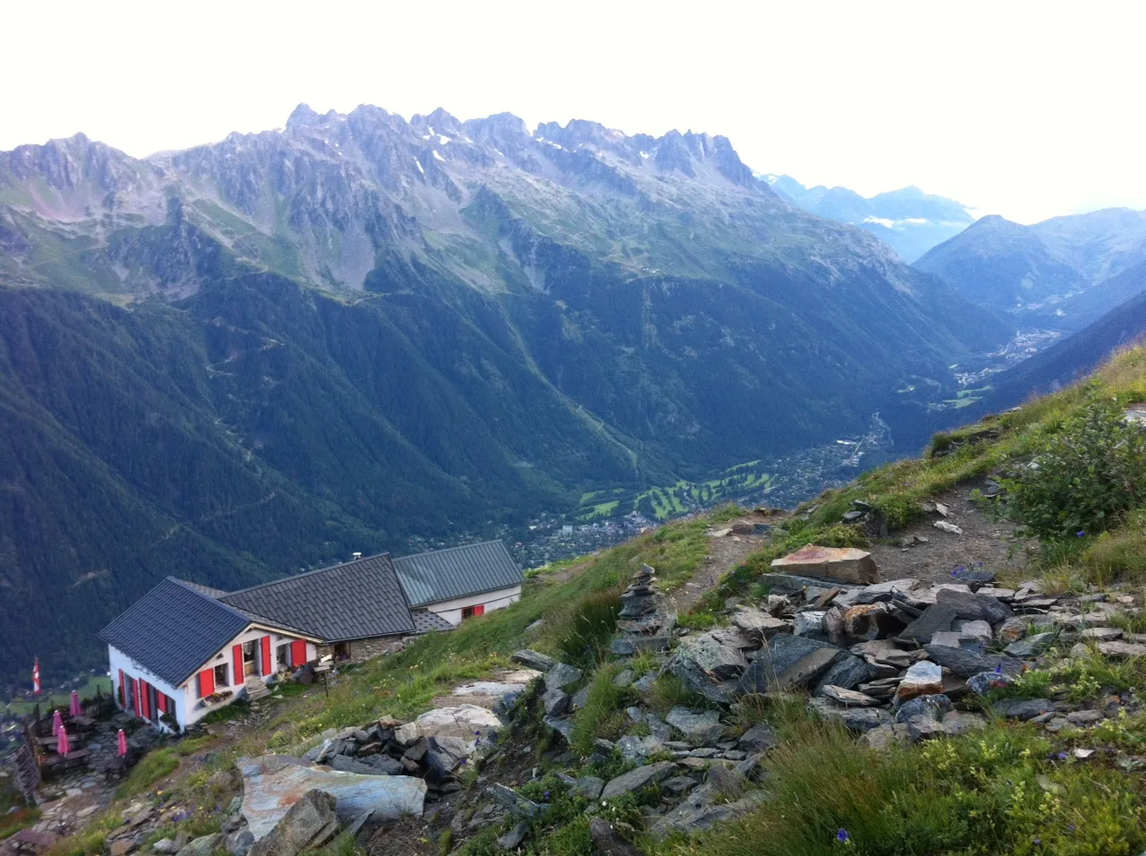
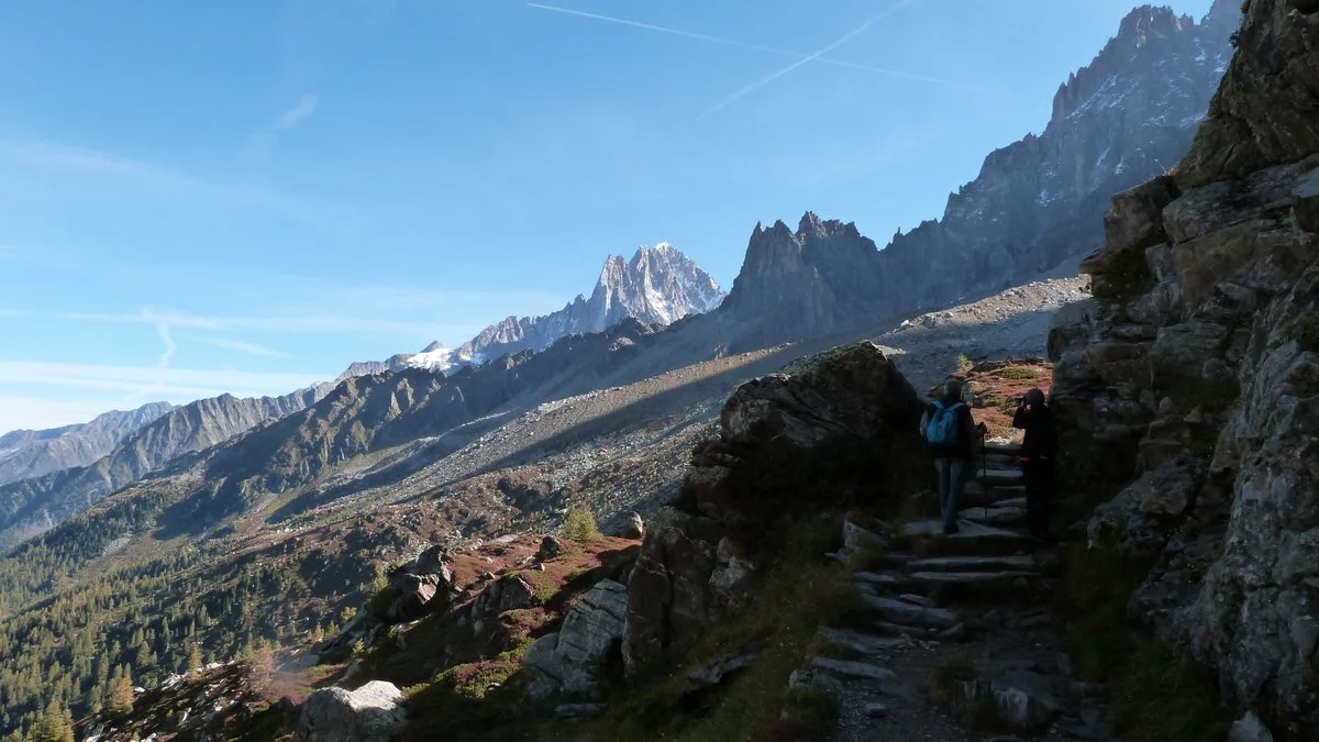
From the cable car station, descend towards the Refuge du Plan de l'Aiguille. Do not take the two paths descending to Chamonix via the Plan du Trois or the Pré du Rocher. Go horizontally to the right on the path that crosses the Tapia, the torrent and the bottom of the moraines of the glaciers of Blaitière, then Nantillons.
At this point, leave the Chamonix path on the left through the Alpages de Blaitière.
Continue horizontally crossing the Grépon torrent. Above
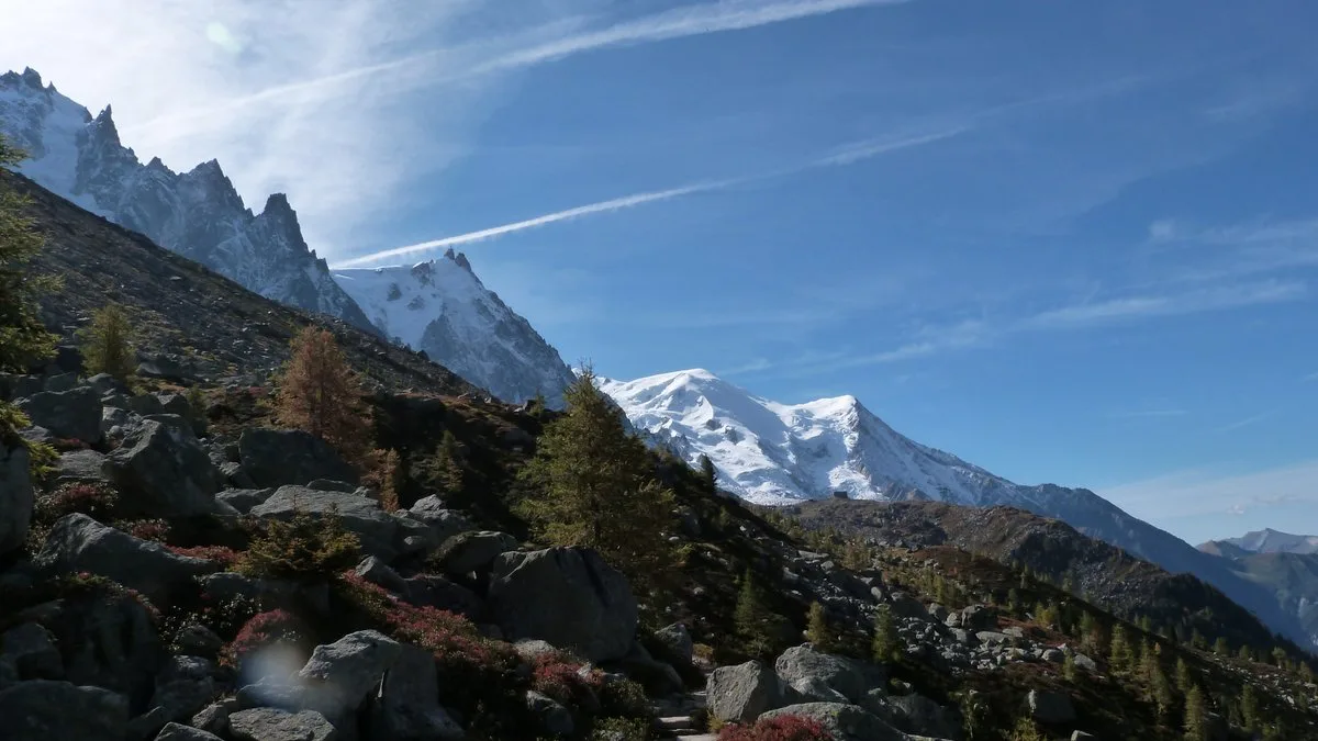
from Grand-Chalet, take a moment to admire the panorama
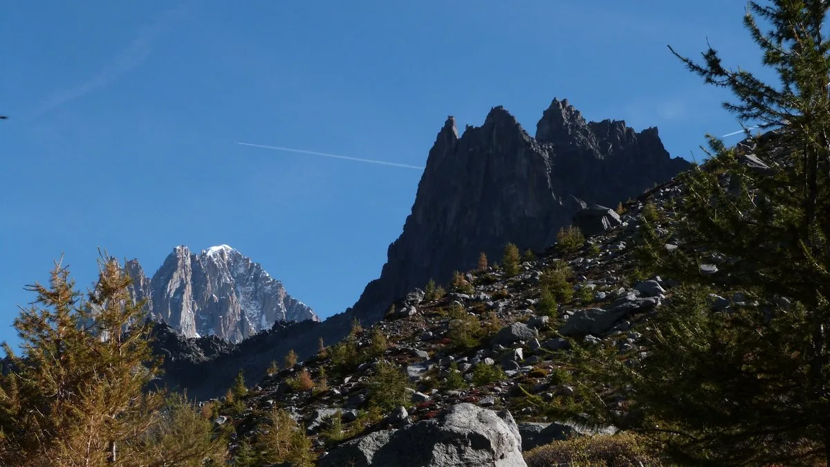
impressive Aiguilles de Chamonix: I'M, les Charmoz, Blaitière, le Plan, l'Aiguille du Midi… and Mont-Blanc.
Shortly after, at 2 m, a fork: on the left a steep shortcut leads
at Montenvers by cutting steep corridors dangerous in the event of snow (diff.:
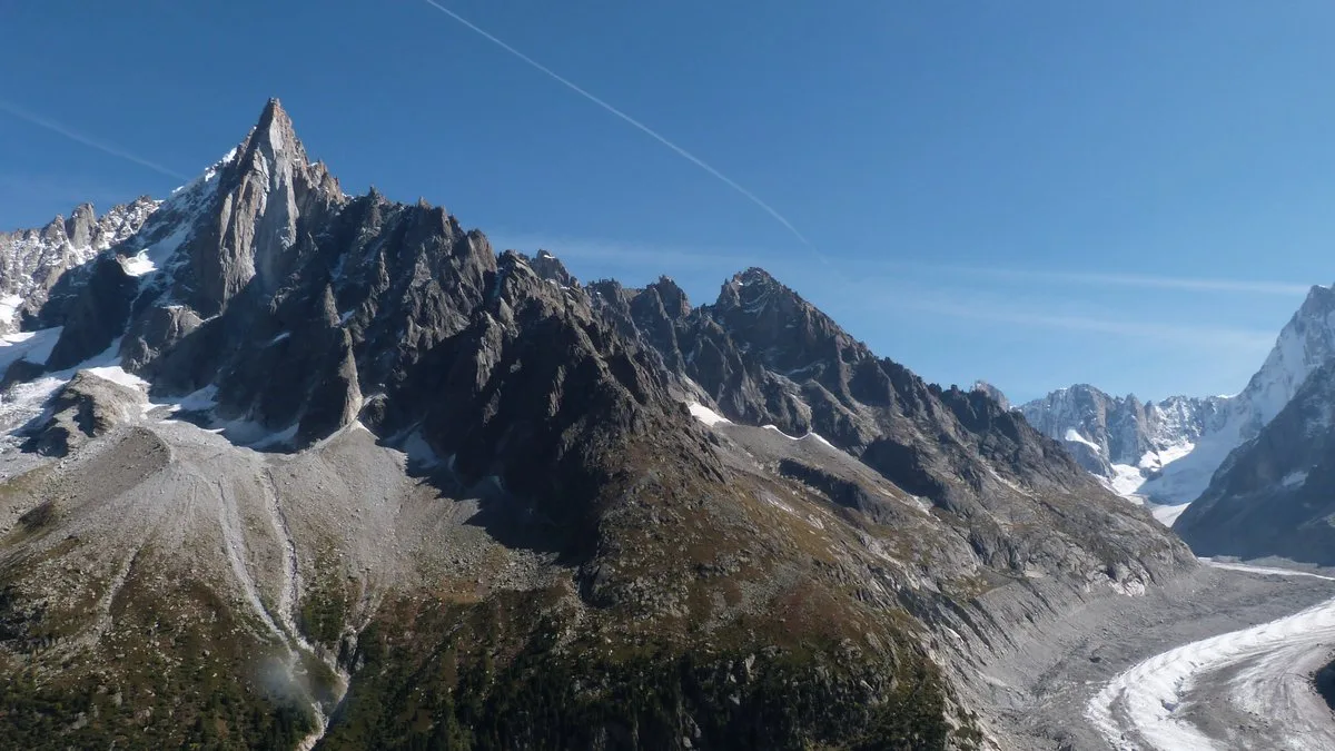
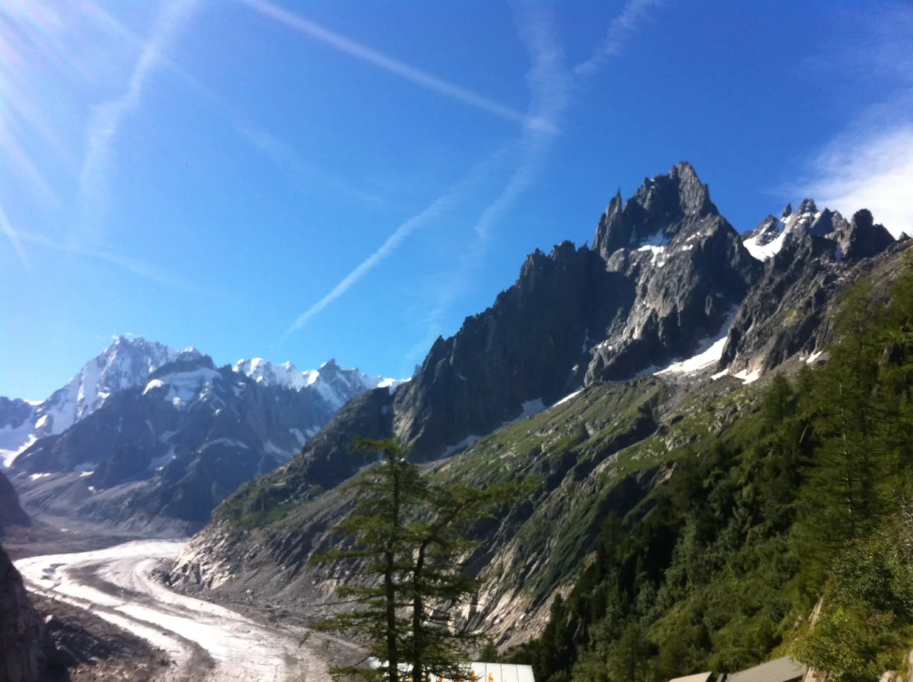
for experienced hikers). Take the panoramic path on the right via a winding climb and a crossing which ends at the Signal lower Charmoz, then at the Signal Forbes (2 m). The view changes suddenly: the Drus, the Verte, the Jorasses… Go down a large slope on the Mer de Glace side via large bends to reach the Montenvers, the hotel and the train station.
Possibility of doing it from Montenvers to the Aiguille du Midi.
In summer, remember to reserve your skip for the Plan de l'Aiguille because the number of people at the cable car is high.
Check opening dates and times before leaving.
More information available at the Tourist Office or the Haute-Montagne Office and in our trail guide.
Please note: The conditions of the trails are subject to change, remember to inquire before leaving.
At this point, leave the Chamonix path on the left through the Alpages de Blaitière.
Continue horizontally crossing the Grépon torrent. Above
from Grand-Chalet, take a moment to admire the panorama
impressive Aiguilles de Chamonix: I'M, les Charmoz, Blaitière, le Plan, l'Aiguille du Midi… and Mont-Blanc.
Shortly after, at 2 m, a fork: on the left a steep shortcut leads
at Montenvers by cutting steep corridors dangerous in the event of snow (diff.:
for experienced hikers). Take the panoramic path on the right via a winding climb and a crossing which ends at the Signal lower Charmoz, then at the Signal Forbes (2 m). The view changes suddenly: the Drus, the Verte, the Jorasses… Go down a large slope on the Mer de Glace side via large bends to reach the Montenvers, the hotel and the train station.
Possibility of doing it from Montenvers to the Aiguille du Midi.
In summer, remember to reserve your skip for the Plan de l'Aiguille because the number of people at the cable car is high.
Check opening dates and times before leaving.
More information available at the Tourist Office or the Haute-Montagne Office and in our trail guide.
Please note: The conditions of the trails are subject to change, remember to inquire before leaving.